https://aisresources.com/wp-content/uploads/2016/11/AIS-Logo-1-loading-icon.png
0
0
AIS-H
https://aisresources.com/wp-content/uploads/2016/11/AIS-Logo-1-loading-icon.png
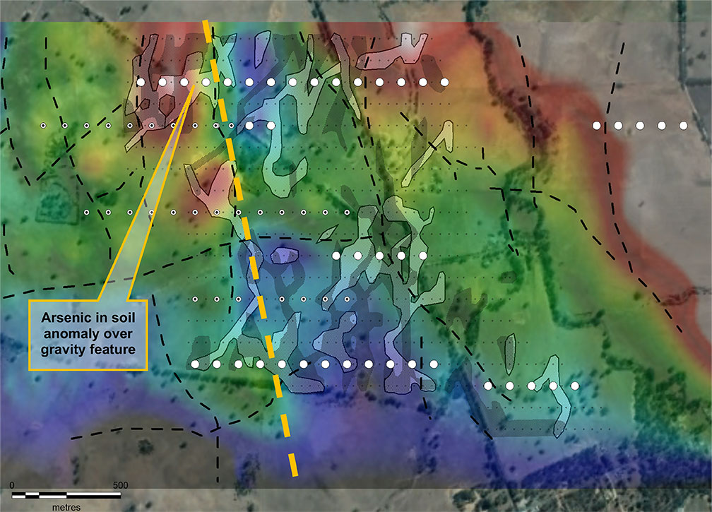
AIS-H2021-11-04 00:06:042022-03-03 04:23:21Drillhole locations identified as white dots and previous drill holes black and white dots. Arsenic in soil contours over an upper continued gravity image with white shaded areas are the arsenic soil anomalies. Black dotted lines are the faults / lithoboundaries. The yellow dotted line shows the arsenic trend along the gravity edge.
Scroll to top
![[Most Recent Quotes from www.kitco.com]](https://www.kitconet.com/charts/metals/gold/tny_au_en_usoz_2.gif)